Mont_Dore_Puy_Sancy

jagarnier
User GUIDE
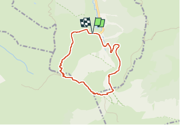

Length
6.8 km

Max alt
1862 m

Uphill gradient
536 m
Km-Effort
13.9 km

Min alt
1321 m

Downhill gradient
534 m
Boucle
Yes
Creation date :
2019-12-31 08:34:32.057
Updated on :
2024-12-13 08:01:41.839
2h00
Difficulty : Difficult

FREE GPS app for hiking
 SityTrail
IGN / Geographical institutes
SityTrail Plus
The world is yours!
About
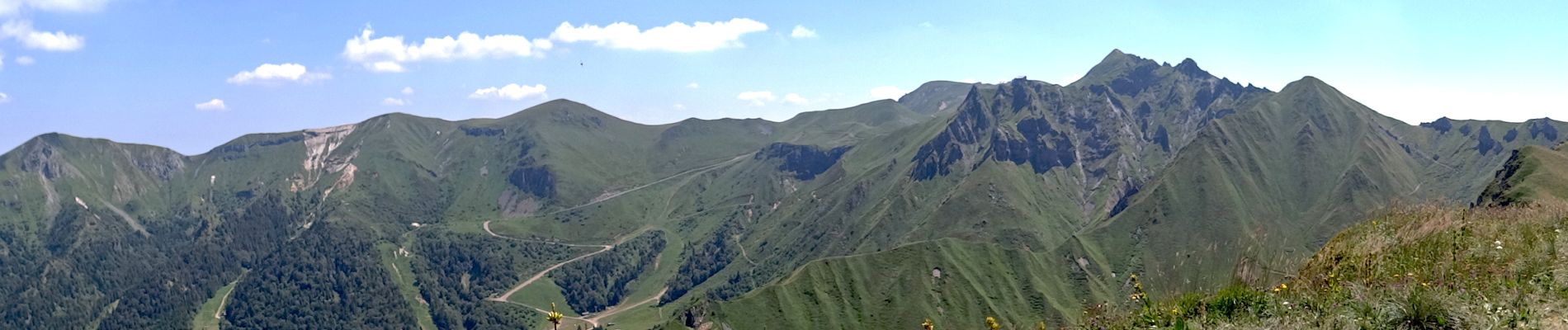
Trail Walking of 6.8 km to be discovered at Auvergne-Rhône-Alpes, Puy-de-Dôme, Mont-Dore. This trail is proposed by jagarnier.
Photos


Positioning
Country:
France
Region :
Auvergne-Rhône-Alpes
Department/Province :
Puy-de-Dôme
Municipality :
Mont-Dore
Location:
Unknown
Start:(Dec)
Start:(UTM)
485507 ; 5043192 (31T) N.
Comments