


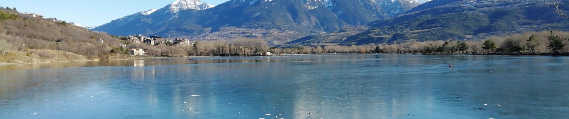
EMBRUN tour du plan d'eau

SyMA
User
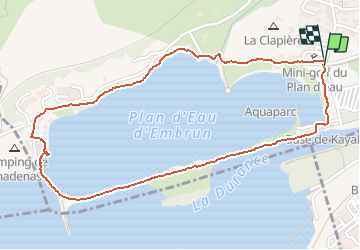

Length
2.7 km

Max alt
791 m

Uphill gradient
21 m
Km-Effort
3 km

Min alt
776 m

Downhill gradient
18 m
Boucle
Yes
Creation date :
2020-01-01 10:04:21.429
Updated on :
2020-01-03 15:43:46.415
43m
Difficulty : Very easy

FREE GPS app for hiking
 SityTrail
IGN / Geographical institutes
SityTrail Plus
The world is yours!
About
Trail Walking of 2.7 km to be discovered at Provence-Alpes-Côte d'Azur, Hautes-Alpes, Embrun. This trail is proposed by SyMA.
Description
balade tres facile autour du plan d'eau d'EMBRUN
Photos

Positioning
Country:
France
Region :
Provence-Alpes-Côte d'Azur
Department/Province :
Hautes-Alpes
Municipality :
Embrun
Location:
Unknown
Start:(Dec)
Start:(UTM)
299763 ; 4936129 (32T) N.
Comments