


la préférée de bernard

bendoush
User

Length
26 km

Max alt
431 m

Uphill gradient
257 m
Km-Effort
30 km

Min alt
204 m

Downhill gradient
403 m
Boucle
No
Creation date :
2020-01-01 12:53:18.802
Updated on :
2020-01-01 16:22:41.125
3h28
Difficulty : Very easy

FREE GPS app for hiking
 SityTrail
IGN / Geographical institutes
SityTrail Plus
The world is yours!
About
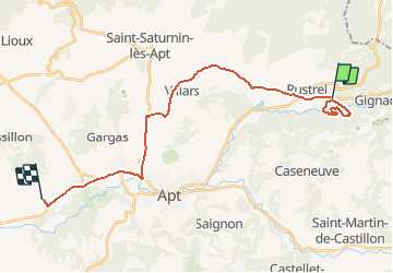
Trail Walking of 26 km to be discovered at Provence-Alpes-Côte d'Azur, Vaucluse, Rustrel. This trail is proposed by bendoush.
Positioning
Country:
France
Region :
Provence-Alpes-Côte d'Azur
Department/Province :
Vaucluse
Municipality :
Rustrel
Location:
Unknown
Start:(Dec)
Start:(UTM)
700729 ; 4865980 (31T) N.
Comments