Trail Walking Remire-Montjoly - rorota en famille - Photo
 BorisKo
BorisKo

User

© OpenStreetMap contributors
Length
Length
6.2 km
Max alt
Max alt
178 m
Uphill gradient
Uphill gradient
174 m
Km-Effort
Km-Effort  
8.5 km
Min alt
Min alt
37 m
Downhill gradient
Downhill gradient
174 m
Boucle
Boucle
Yes
Creation date :
2020-01-03 13:24:18.261
Updated on :
2020-01-03 15:35:40.379

(0 Reviews)

Walking
Walking
2h10
Difficulty : Easy

Scan this QR Code to open this trail in the SityTrail application

FREE GPS app for hiking

Logo SityTrail SityTrail

IGN / Geographical institutes

Download SityTrail from the App Store Download SityTrail from Google Play

Logo SityTrail SityTrail World

The world is yours!

Download SityTrail from the App Store Download SityTrail from Google Play Download SityTrail on Huawei AppGallery

About

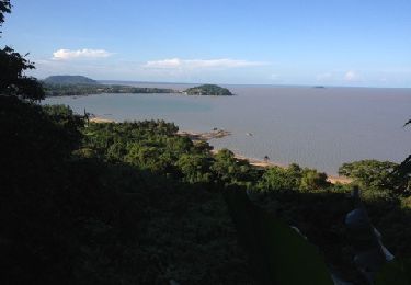
Trail Walking of 6.2 km to be discovered at French Guiana, Unknown, Remire-Montjoly. This trail is proposed by BorisKo.

Description

Rorota, Cayenne, Guyane française

Elevation profile

Positioning

Country:
France
Region :
French Guiana
Department/Province :
Unknown
Municipality :
Remire-Montjoly
Location:
Unknown
Start:(UTM)
360012 ; 540330 (22N) N.

Trails nearby

Trail Walking Remire-Montjoly - Rorota  - Photo
Walking
gilbert.poirier

Walking

Very easy
Remire-Montjoly, French Guiana, Unknown, France
15.8 km | 19.6 km-effort
2h 40min
No


Close
My subscriptions