


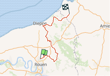
HOUPPEVILLE AIGNEVILLE

db
User

Length
146 km

Max alt
224 m

Uphill gradient
3223 m
Km-Effort
189 km

Min alt
10 m

Downhill gradient
3237 m
Boucle
No
Creation date :
2014-12-10 00:00:00.0
Updated on :
2014-12-10 00:00:00.0
5h50
Difficulty : Unknown

FREE GPS app for hiking
 SityTrail
IGN / Geographical institutes
SityTrail Plus
The world is yours!
About
Trail Other activity of 146 km to be discovered at Normandy, Seine-Maritime, Houppeville. This trail is proposed by db.
Positioning
Country:
France
Region :
Normandy
Department/Province :
Seine-Maritime
Municipality :
Houppeville
Location:
Unknown
Start:(Dec)
Start:(UTM)
361593 ; 5485391 (31U) N.
Comments