


canalettes

lablaquiere
User
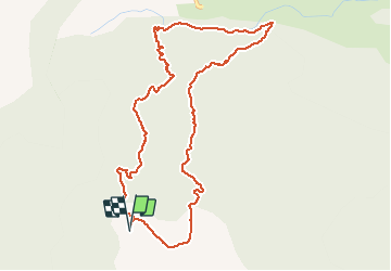

Length
5.5 km

Max alt
709 m

Uphill gradient
201 m
Km-Effort
8.2 km

Min alt
527 m

Downhill gradient
202 m
Boucle
Yes
Creation date :
2020-01-04 15:30:00.548
Updated on :
2020-01-04 17:04:53.379
1h20
Difficulty : Very easy

FREE GPS app for hiking
 SityTrail
IGN / Geographical institutes
SityTrail Plus
The world is yours!
About
Trail Walking of 5.5 km to be discovered at Occitania, Aveyron, Nant. This trail is proposed by lablaquiere.
Positioning
Country:
France
Region :
Occitania
Department/Province :
Aveyron
Municipality :
Nant
Location:
Unknown
Start:(Dec)
Start:(UTM)
520796 ; 4869624 (31T) N.
Comments