


st rome de cernon

lablaquiere
User
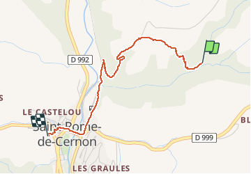

Length
3 km

Max alt
503 m

Uphill gradient
101 m
Km-Effort
4.4 km

Min alt
401 m

Downhill gradient
107 m
Boucle
No
Creation date :
2020-01-05 14:46:20.086
Updated on :
2020-01-05 16:09:31.241
1h04
Difficulty : Very easy

FREE GPS app for hiking
 SityTrail
IGN / Geographical institutes
SityTrail Plus
The world is yours!
About
Trail Walking of 3 km to be discovered at Occitania, Aveyron, Saint-Rome-de-Cernon. This trail is proposed by lablaquiere.
Positioning
Country:
France
Region :
Occitania
Department/Province :
Aveyron
Municipality :
Saint-Rome-de-Cernon
Location:
Unknown
Start:(Dec)
Start:(UTM)
498483 ; 4873884 (31T) N.
Comments