


Mt Aurelien-batailloles

bernir
User
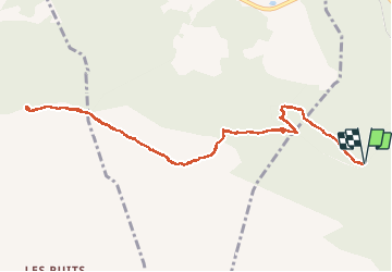

Length
12.5 km

Max alt
874 m

Uphill gradient
478 m
Km-Effort
18.9 km

Min alt
489 m

Downhill gradient
480 m
Boucle
Yes
Creation date :
2020-01-05 10:21:32.376
Updated on :
2020-01-06 21:39:41.099
8h31
Difficulty : Medium

FREE GPS app for hiking
 SityTrail
IGN / Geographical institutes
SityTrail Plus
The world is yours!
About
Trail Walking of 12.5 km to be discovered at Provence-Alpes-Côte d'Azur, Var, Saint-Maximin-la-Sainte-Baume. This trail is proposed by bernir.
Positioning
Country:
France
Region :
Provence-Alpes-Côte d'Azur
Department/Province :
Var
Municipality :
Saint-Maximin-la-Sainte-Baume
Location:
Unknown
Start:(Dec)
Start:(UTM)
728297 ; 4814081 (31T) N.
Comments