Trail Walking Hyères - m8l - Photo
© OpenStreetMap contributors
Length
Length
11.5 km
Max alt
Max alt
86 m
Uphill gradient
Uphill gradient
257 m
Km-Effort
Km-Effort  
14.9 km
Min alt
Min alt
-1 m
Downhill gradient
Downhill gradient
237 m
Boucle
Boucle
No
Creation date :
2020-01-06 08:17:56.795
Updated on :
2020-01-07 05:27:17.895

(0 Reviews)

Walking
Walking
3h28
Difficulty : Medium

Scan this QR Code to open this trail in the SityTrail application

FREE GPS app for hiking

Logo SityTrail SityTrail

IGN / Geographical institutes

Download SityTrail from the App Store Download SityTrail from Google Play

Logo SityTrail SityTrail Plus

The world is yours!

Download SityTrail from the App Store Download SityTrail from Google Play Download SityTrail on Huawei AppGallery

About

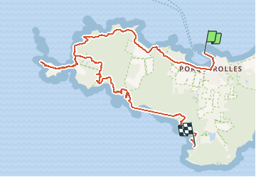
Trail Walking of 11.5 km to be discovered at Provence-Alpes-Côte d'Azur, Var, Hyères. This trail is proposed by ymobernard.

Description

On ne omLe texte que vous copiez s'affichera automatiquement iciLe texte que vous copiez s'affichera automatiquement iciLe texte que vous copiez s'affichera automatiquement iciFaites glisser des clips pour les supprimerLe texte que vous copiez s'affichera automatiquement iciÉpinglez les morceaux de texte copiés pour qu'ils n'expirent pas après 1 heure

Elevation profile

Positioning

Country:
France
Region :
Provence-Alpes-Côte d'Azur
Department/Province :
Var
Municipality :
Hyères
Location:
Unknown
Start:(UTM)
271850 ; 4764941 (32T) N.


Close
My subscriptions