


MONTFLEURY LAVILLEDIEU 07-01-2020

issartelserge
User
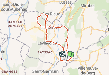

Length
15.5 km

Max alt
324 m

Uphill gradient
278 m
Km-Effort
19.2 km

Min alt
212 m

Downhill gradient
278 m
Boucle
Yes
Creation date :
2020-01-07 08:38:24.0
Updated on :
2020-01-08 04:44:09.413
5h10
Difficulty : Unknown

FREE GPS app for hiking
 SityTrail
IGN / Geographical institutes
SityTrail Plus
The world is yours!
About
Trail Walking of 15.5 km to be discovered at Auvergne-Rhône-Alpes, Ardèche, Mirabel. This trail is proposed by issartelserge.
Description
FACILE- PASSAGE AU DOLMEN DE MIAS -
Positioning
Country:
France
Region :
Auvergne-Rhône-Alpes
Department/Province :
Ardèche
Municipality :
Mirabel
Location:
Unknown
Start:(Dec)
Start:(UTM)
617102 ; 4935499 (31T) N.
Comments