


10861659-Carry le Rouet - Vallon de Jaume par les Grottes

togolo28
User
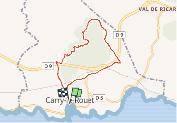

Length
7.7 km

Max alt
151 m

Uphill gradient
209 m
Km-Effort
10.5 km

Min alt
7 m

Downhill gradient
209 m
Boucle
Yes
Creation date :
2020-01-07 17:29:59.879
Updated on :
2020-01-07 17:30:25.416
--
Difficulty : Easy

FREE GPS app for hiking
 SityTrail
IGN / Geographical institutes
SityTrail Plus
The world is yours!
About
Trail Walking of 7.7 km to be discovered at Provence-Alpes-Côte d'Azur, Bouches-du-Rhône, Carry-le-Rouet. This trail is proposed by togolo28.
Positioning
Country:
France
Region :
Provence-Alpes-Côte d'Azur
Department/Province :
Bouches-du-Rhône
Municipality :
Carry-le-Rouet
Location:
Unknown
Start:(Dec)
Start:(UTM)
674499 ; 4799803 (31T) N.
Comments