


Rignac le buenne 2

bouscaillou
User
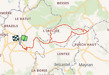

Length
21 km

Max alt
735 m

Uphill gradient
445 m
Km-Effort
27 km

Min alt
491 m

Downhill gradient
445 m
Boucle
Yes
Creation date :
2020-01-08 12:16:49.565
Updated on :
2020-01-08 17:38:13.461
5h16
Difficulty : Very easy

FREE GPS app for hiking
 SityTrail
IGN / Geographical institutes
SityTrail Plus
The world is yours!
About
Trail Walking of 21 km to be discovered at Occitania, Aveyron, Rignac. This trail is proposed by bouscaillou.
Positioning
Country:
France
Region :
Occitania
Department/Province :
Aveyron
Municipality :
Rignac
Location:
Unknown
Start:(Dec)
Start:(UTM)
443415 ; 4917047 (31T) N.
Comments