


Methamis

FLORENSAC
User

Length
21 km

Max alt
680 m

Uphill gradient
584 m
Km-Effort
28 km

Min alt
282 m

Downhill gradient
584 m
Boucle
Yes
Creation date :
2020-01-05 08:33:02.835
Updated on :
2020-01-08 18:37:18.704
6h38
Difficulty : Medium

FREE GPS app for hiking
 SityTrail
IGN / Geographical institutes
SityTrail Plus
The world is yours!
About
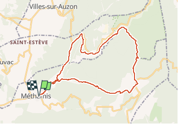
Trail Walking of 21 km to be discovered at Provence-Alpes-Côte d'Azur, Vaucluse, Méthamis. This trail is proposed by FLORENSAC.
Description
Départ parking derrière l'école primaire
une jolie randonnée
sans difficultés particulières
retour dans la caillasse comme on dit chez nous
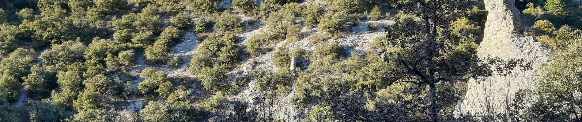
Photos


Positioning
Country:
France
Region :
Provence-Alpes-Côte d'Azur
Department/Province :
Vaucluse
Municipality :
Méthamis
Location:
Unknown
Start:(Dec)
Start:(UTM)
678299 ; 4875755 (31T) N.
Comments