


semnoz

Chantal74
User
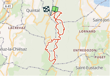

Length
17.7 km

Max alt
1662 m

Uphill gradient
663 m
Km-Effort
27 km

Min alt
1032 m

Downhill gradient
661 m
Boucle
Yes
Creation date :
2020-01-12 07:03:10.578
Updated on :
2020-01-12 07:06:02.593
--
Difficulty : Difficult

FREE GPS app for hiking
 SityTrail
IGN / Geographical institutes
SityTrail Plus
The world is yours!
About
Trail On foot of 17.7 km to be discovered at Auvergne-Rhône-Alpes, Upper Savoy, Sevrier. This trail is proposed by Chantal74.
Description
en partant de la bifurcation de Quintal, montée au Semnoz
Positioning
Country:
France
Region :
Auvergne-Rhône-Alpes
Department/Province :
Upper Savoy
Municipality :
Sevrier
Location:
Unknown
Start:(Dec)
Start:(UTM)
275161 ; 5079977 (32T) N.
Comments