chandolas

Michel07
User

Length
9.5 km

Max alt
206 m

Uphill gradient
149 m
Km-Effort
11.5 km

Min alt
120 m

Downhill gradient
149 m
Boucle
Yes
Creation date :
2014-12-10 00:00:00.0
Updated on :
2014-12-10 00:00:00.0
2h17
Difficulty : Easy

FREE GPS app for hiking
 SityTrail
IGN / Geographical institutes
SityTrail Plus
The world is yours!
About
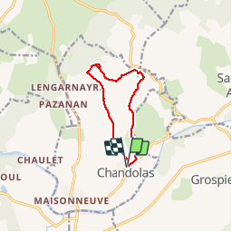
Trail Walking of 9.5 km to be discovered at Auvergne-Rhône-Alpes, Ardèche, Chandolas. This trail is proposed by Michel07.
Positioning
Country:
France
Region :
Auvergne-Rhône-Alpes
Department/Province :
Ardèche
Municipality :
Chandolas
Location:
Unknown
Start:(Dec)
Start:(UTM)
599806 ; 4917458 (31T) N.
Comments