Bellindron

raymondfn
User

Length
10.7 km

Max alt
677 m

Uphill gradient
237 m
Km-Effort
13.9 km

Min alt
503 m

Downhill gradient
237 m
Boucle
Yes
Creation date :
2014-12-10 00:00:00.0
Updated on :
2014-12-10 00:00:00.0
3h00
Difficulty : Easy

FREE GPS app for hiking
 SityTrail
IGN / Geographical institutes
SityTrail Plus
The world is yours!
About
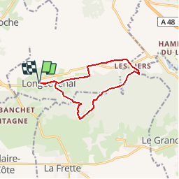
Trail Walking of 10.7 km to be discovered at Auvergne-Rhône-Alpes, Isère, Longechenal. This trail is proposed by raymondfn.
Description
Départ : Longechenal
PR du Pays de BIèvre-Valloire (partie)
Positioning
Country:
France
Region :
Auvergne-Rhône-Alpes
Department/Province :
Isère
Municipality :
Longechenal
Location:
Unknown
Start:(Dec)
Start:(UTM)
683654 ; 5032095 (31T) N.
Comments