


Venasque/ combe de vaulongue

FLORENSAC
User
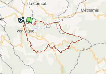

Length
19.6 km

Max alt
570 m

Uphill gradient
738 m
Km-Effort
29 km

Min alt
177 m

Downhill gradient
738 m
Boucle
Yes
Creation date :
2020-01-16 08:38:10.962
Updated on :
2020-01-23 20:08:42.261
6h31
Difficulty : Medium

FREE GPS app for hiking
 SityTrail
IGN / Geographical institutes
SityTrail Plus
The world is yours!
About
Trail Walking of 19.6 km to be discovered at Provence-Alpes-Côte d'Azur, Vaucluse, Venasque. This trail is proposed by FLORENSAC.
Description
Rando pas très difficile avec un bon dénivelé
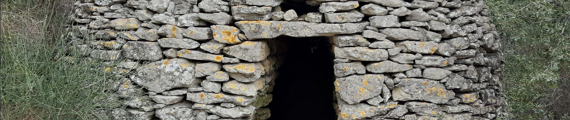
de jolies bories à découvrir sur le retour
Photos


Positioning
Country:
France
Region :
Provence-Alpes-Côte d'Azur
Department/Province :
Vaucluse
Municipality :
Venasque
Location:
Unknown
Start:(Dec)
Start:(UTM)
672132 ; 4874081 (31T) N.
Comments