Trail Walking Le Chambon-Feugerolles - Cotatay de long en large - Photo
© OpenStreetMap contributors
Length
Length
12.1 km
Max alt
Max alt
771 m
Uphill gradient
Uphill gradient
373 m
Km-Effort
Km-Effort  
17.1 km
Min alt
Min alt
534 m
Downhill gradient
Downhill gradient
376 m
Boucle
Boucle
Yes
Creation date :
2020-01-17 07:06:04.699
Updated on :
2020-01-18 07:05:14.4

(0 Reviews)

Walking
Walking
3h36
Difficulty : Difficult

Scan this QR Code to open this trail in the SityTrail application

FREE GPS app for hiking

Logo SityTrail SityTrail

IGN / Geographical institutes

Download SityTrail from the App Store Download SityTrail from Google Play

Logo SityTrail SityTrail Plus

The world is yours!

Download SityTrail from the App Store Download SityTrail from Google Play Download SityTrail on Huawei AppGallery

About

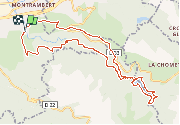
Trail Walking of 12.1 km to be discovered at Auvergne-Rhône-Alpes, Loire, Le Chambon-Feugerolles. This trail is proposed by TheRingoKid.

Description

Un grand tour qui vous fera découvrir la vallée de Cotatay et ses curiosités.

Départ : Cotatay quartier des eaux vives
Arrivée : Cotatay quartier des eaux vives
Points d'intérêts le long du parcours :
- caserne Holtzer
- chapelle de la Sauvanière
- aqueduc du Lignon
- grotte de Cotatay
- barrage de Cotatay
- croix et table d'orientation du Bessy

Bonne promenade

Elevation profile

Positioning

Country:
France
Region :
Auvergne-Rhône-Alpes
Department/Province :
Loire
Municipality :
Le Chambon-Feugerolles
Location:
Unknown
Start:(UTM)
605533 ; 5027394 (31T) N.


Close
My subscriptions