


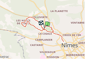
Tour Magne Hauts de Nimes

grageot
User

Length
16 km

Max alt
183 m

Uphill gradient
276 m
Km-Effort
19.7 km

Min alt
76 m

Downhill gradient
274 m
Boucle
Yes
Creation date :
2020-01-18 19:29:17.403
Updated on :
2020-01-18 19:32:20.75
--
Difficulty : Medium

FREE GPS app for hiking
 SityTrail
IGN / Geographical institutes
SityTrail Plus
The world is yours!
About
Trail On foot of 16 km to be discovered at Occitania, Gard, Nimes. This trail is proposed by grageot.
Positioning
Country:
France
Region :
Occitania
Department/Province :
Gard
Municipality :
Nimes
Location:
Unknown
Start:(Dec)
Start:(UTM)
606333 ; 4856549 (31T) N.
Comments