


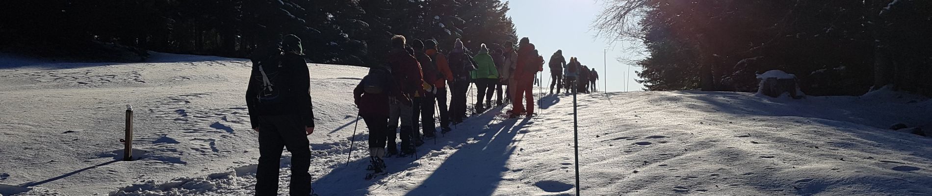
A Jura - lundi 20/01/2020 - rando de l'après-midi - les Copettes

VANDERPUTTENMi
User GUIDE
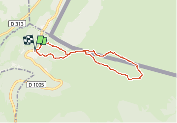

Length
3.8 km

Max alt
1372 m

Uphill gradient
122 m
Km-Effort
5.4 km

Min alt
1246 m

Downhill gradient
127 m
Boucle
Yes
Creation date :
2020-01-21 08:31:23.517
Updated on :
2020-01-28 08:52:01.651
2h34
Difficulty : Very easy

FREE GPS app for hiking
 SityTrail
IGN / Geographical institutes
SityTrail Plus
The world is yours!
About
Trail Walking of 3.8 km to be discovered at Auvergne-Rhône-Alpes, Ain, Divonne-les-Bains. This trail is proposed by VANDERPUTTENMi.
Photos

Positioning
Country:
France
Region :
Auvergne-Rhône-Alpes
Department/Province :
Ain
Municipality :
Divonne-les-Bains
Location:
Unknown
Start:(Dec)
Start:(UTM)
274154 ; 5144295 (32T) N.
Comments