


Stevenson :

ARPF1
User
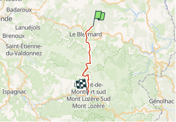

Length
23 km

Max alt
1699 m

Uphill gradient
671 m
Km-Effort
33 km

Min alt
875 m

Downhill gradient
973 m
Boucle
No
Creation date :
2020-01-21 12:44:26.362
Updated on :
2020-01-21 12:46:56.066
6h20
Difficulty : Difficult

FREE GPS app for hiking
 SityTrail
IGN / Geographical institutes
SityTrail Plus
The world is yours!
About
Trail On foot of 23 km to be discovered at Occitania, Lozère, Cubières. This trail is proposed by ARPF1.
Positioning
Country:
France
Region :
Occitania
Department/Province :
Lozère
Municipality :
Cubières
Location:
Unknown
Start:(Dec)
Start:(UTM)
560191 ; 4927786 (31T) N.
Comments