


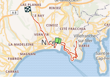
Nice Mont Boron, Mont Alban, cap de Nice

reneperrin
User

Length
17.1 km

Max alt
223 m

Uphill gradient
379 m
Km-Effort
22 km

Min alt
3 m

Downhill gradient
331 m
Boucle
No
Creation date :
2020-01-25 12:58:38.507
Updated on :
2020-01-25 17:53:16.897
3h59
Difficulty : Easy

FREE GPS app for hiking
 SityTrail
IGN / Geographical institutes
SityTrail Plus
The world is yours!
About
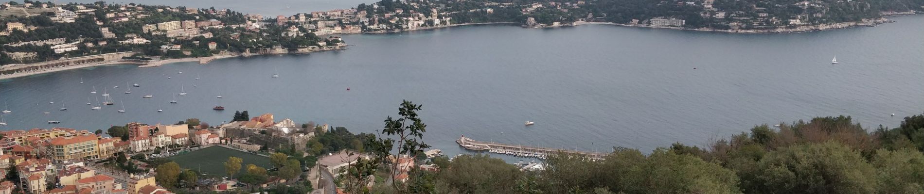
Trail Walking of 17.1 km to be discovered at Provence-Alpes-Côte d'Azur, Maritime Alps, Nice. This trail is proposed by reneperrin.
Description
Randonnée en boucle avec de beau points de vue sur Nice et cap Ferrat
Photos


Positioning
Country:
France
Region :
Provence-Alpes-Côte d'Azur
Department/Province :
Maritime Alps
Municipality :
Nice
Location:
Unknown
Start:(Dec)
Start:(UTM)
360956 ; 4839644 (32T) N.
Comments