


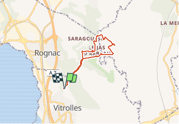
Vitrolles radar tour de guet

Nathy8913
User

Length
11.7 km

Max alt
268 m

Uphill gradient
162 m
Km-Effort
13.9 km

Min alt
192 m

Downhill gradient
163 m
Boucle
Yes
Creation date :
2020-01-26 09:26:27.577
Updated on :
2020-01-26 13:37:14.857
4h09
Difficulty : Easy

FREE GPS app for hiking
 SityTrail
IGN / Geographical institutes
SityTrail Plus
The world is yours!
About
Trail Walking of 11.7 km to be discovered at Provence-Alpes-Côte d'Azur, Bouches-du-Rhône, Vitrolles. This trail is proposed by Nathy8913.
Positioning
Country:
France
Region :
Provence-Alpes-Côte d'Azur
Department/Province :
Bouches-du-Rhône
Municipality :
Vitrolles
Location:
Unknown
Start:(Dec)
Start:(UTM)
681724 ; 4815336 (31T) N.
Comments