


Pic d'Endron

philou6351
User
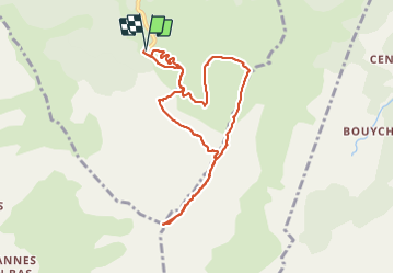

Length
10.1 km

Max alt
2459 m

Uphill gradient
1017 m
Km-Effort
24 km

Min alt
1474 m

Downhill gradient
1023 m
Boucle
Yes
Creation date :
2014-12-10 00:00:00.0
Updated on :
2021-09-24 21:07:48.331
2h33
Difficulty : Very easy

FREE GPS app for hiking
 SityTrail
IGN / Geographical institutes
SityTrail Plus
The world is yours!
About
Trail Walking of 10.1 km to be discovered at Occitania, Ariège, Val-de-Sos. This trail is proposed by philou6351.


Positioning
Country:
France
Region :
Occitania
Department/Province :
Ariège
Municipality :
Val-de-Sos
Location:
Goulier
Start:(Dec)
Start:(UTM)
378363 ; 4732972 (31T) N.
Comments