


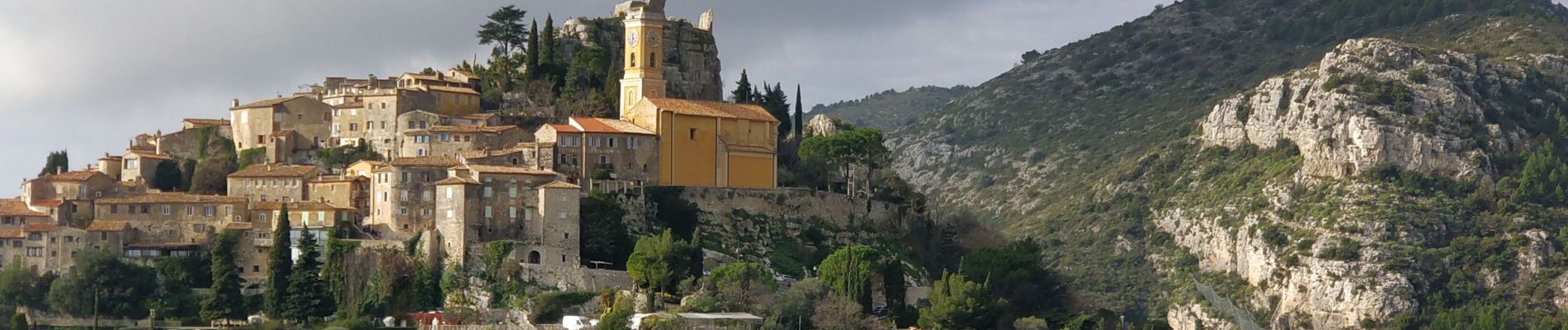
Eze

reneperrin
User
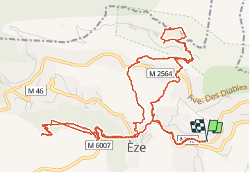

Length
9.6 km

Max alt
697 m

Uphill gradient
632 m
Km-Effort
18.1 km

Min alt
315 m

Downhill gradient
632 m
Boucle
Yes
Creation date :
2020-01-26 10:27:47.03
Updated on :
2020-01-26 15:21:40.808
3h19
Difficulty : Easy

FREE GPS app for hiking
 SityTrail
IGN / Geographical institutes
SityTrail Plus
The world is yours!
About
Trail Walking of 9.6 km to be discovered at Provence-Alpes-Côte d'Azur, Maritime Alps, Èze. This trail is proposed by reneperrin.
Description
René Fort de la Revère en boucle puis sommet du Mont de la Bastide en aller-retour.
Photos


Positioning
Country:
France
Region :
Provence-Alpes-Côte d'Azur
Department/Province :
Maritime Alps
Municipality :
Èze
Location:
Unknown
Start:(Dec)
Start:(UTM)
368774 ; 4843109 (32T) N.
Comments