Trail Walking Aubigné-Racan - balade - Photo
 il2larai
il2larai

User

© OpenStreetMap contributors
Length
Length
10.4 km
Max alt
Max alt
101 m
Uphill gradient
Uphill gradient
142 m
Km-Effort
Km-Effort  
12.3 km
Min alt
Min alt
40 m
Downhill gradient
Downhill gradient
143 m
Boucle
Boucle
Yes
Creation date :
2020-01-26 13:44:21.196
Updated on :
2020-01-26 16:06:41.349

(0 Reviews)

Walking
Walking
2h21
Difficulty : Very easy

Scan this QR Code to open this trail in the SityTrail application

FREE GPS app for hiking

Logo SityTrail SityTrail

IGN / Geographical institutes

Download SityTrail from the App Store Download SityTrail from Google Play

Logo SityTrail SityTrail World

The world is yours!

Download SityTrail from the App Store Download SityTrail from Google Play Download SityTrail on Huawei AppGallery

About

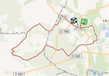
Trail Walking of 10.4 km to be discovered at Pays de la Loire, Sarthe, Aubigné-Racan. This trail is proposed by il2larai.

Elevation profile

Positioning

Country:
France
Region :
Pays de la Loire
Department/Province :
Sarthe
Municipality :
Aubigné-Racan
Location:
Unknown
Start:(UTM)
291852 ; 5283583 (31T) N.

Trails nearby

Trail Electric bike Le Lude - Le Lude - La Mans-18745742 - Photo
Electric bike
LANDRIEU

Electric bike

Very easy
Le Lude, Pays de la Loire, Sarthe, France
51 km | 57 km-effort
Unknown
No
Trail Car La Chapelle-aux-Choux - Modification à faire  - Photo
Car
anthonyperreau

Car

La Chapelle-aux-Choux, Pays de la Loire, Sarthe, France
14 km | 16.7 km-effort
35min
No
Trail Road bike Le Lude - 2nov - Photo
Road bike
anthonyperreau

Road bike

Le Lude, Pays de la Loire, Sarthe, France
12.7 km | 14.4 km-effort
20min
No


Close
My subscriptions