


Chante Épine-Roche de Luchon

pb07
User

Length
13.3 km

Max alt
741 m

Uphill gradient
342 m
Km-Effort
17.9 km

Min alt
446 m

Downhill gradient
344 m
Boucle
Yes
Creation date :
2020-01-27 09:10:52.946
Updated on :
2020-01-27 13:49:31.522
4h15
Difficulty : Very easy

FREE GPS app for hiking
 SityTrail
IGN / Geographical institutes
SityTrail Plus
The world is yours!
About
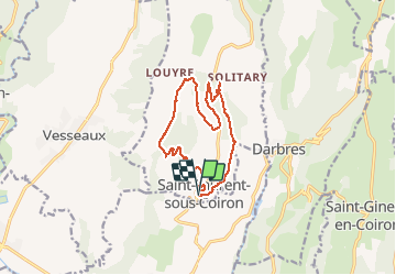
Trail Walking of 13.3 km to be discovered at Auvergne-Rhône-Alpes, Ardèche, Saint-Laurent-sous-Coiron. This trail is proposed by pb07.
Positioning
Country:
France
Region :
Auvergne-Rhône-Alpes
Department/Province :
Ardèche
Municipality :
Saint-Laurent-sous-Coiron
Location:
Unknown
Start:(Dec)
Start:(UTM)
617418 ; 4943710 (31T) N.
Comments