


Xonrupt par traverse JDS Longemer ...

surceneux
User
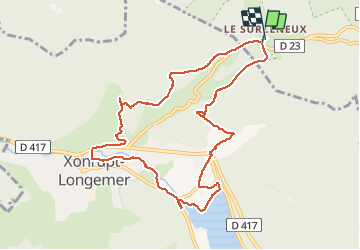

Length
9.7 km

Max alt
856 m

Uphill gradient
210 m
Km-Effort
12.5 km

Min alt
718 m

Downhill gradient
209 m
Boucle
Yes
Creation date :
2020-01-28 08:55:42.927
Updated on :
2020-01-28 11:59:58.254
1h39
Difficulty : Easy

FREE GPS app for hiking
 SityTrail
IGN / Geographical institutes
SityTrail Plus
The world is yours!
About
Trail Walking of 9.7 km to be discovered at Grand Est, Vosges, Ban-sur-Meurthe-Clefcy. This trail is proposed by surceneux.
Description
Xonrupt par traverse JDS Longemer les clés roche du page beheuille
Positioning
Country:
France
Region :
Grand Est
Department/Province :
Vosges
Municipality :
Ban-sur-Meurthe-Clefcy
Location:
Unknown
Start:(Dec)
Start:(UTM)
347784 ; 5329006 (32U) N.
Comments