


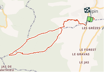
PEIPIN Les crêtes de Lure , chemin des Cotes , gorges de la Fayee o

RobinMicheline
User GUIDE

Length
11.5 km

Max alt
1330 m

Uphill gradient
832 m
Km-Effort
23 km

Min alt
479 m

Downhill gradient
846 m
Boucle
No
Creation date :
2020-01-29 08:08:48.172
Updated on :
2020-01-31 19:01:50.265
5h49
Difficulty : Difficult

FREE GPS app for hiking
 SityTrail
IGN / Geographical institutes
SityTrail Plus
The world is yours!
About
Trail Walking of 11.5 km to be discovered at Provence-Alpes-Côte d'Azur, Alpes-de-Haute-Provence, Aubignosc. This trail is proposed by RobinMicheline.
Positioning
Country:
France
Region :
Provence-Alpes-Côte d'Azur
Department/Province :
Alpes-de-Haute-Provence
Municipality :
Aubignosc
Location:
Unknown
Start:(Dec)
Start:(UTM)
736280 ; 4890629 (31T) N.
Comments