


Rond Oudberg

bometdehamer
User
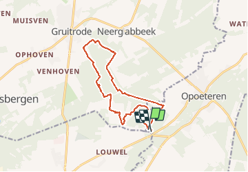

Length
13.4 km

Max alt
89 m

Uphill gradient
133 m
Km-Effort
15.2 km

Min alt
59 m

Downhill gradient
134 m
Boucle
Yes
Creation date :
2020-01-30 09:44:32.0
Updated on :
2020-01-30 14:37:58.585
4h14
Difficulty : Easy

FREE GPS app for hiking
 SityTrail
IGN / Geographical institutes
SityTrail Plus
The world is yours!
About
Trail Walking of 13.4 km to be discovered at Flanders, Limburg, Maaseik. This trail is proposed by bometdehamer.
Description
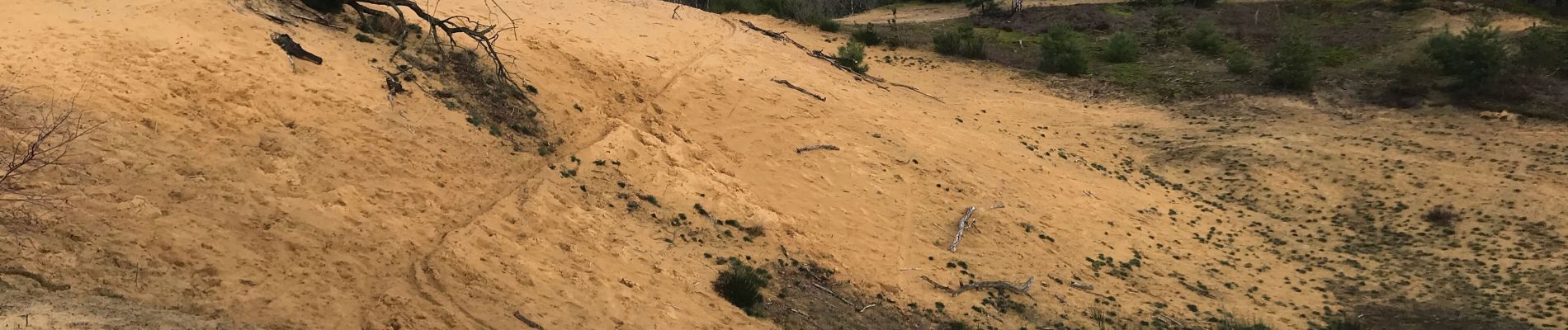
Vertrokken op camping Zavelbos, op en over de Oudsberg, tot in Gruitrode en terug. Traag gewandeld en genoten van kleine dingen, vooral veel zwammen op dood hout..
Photos


Positioning
Country:
Belgium
Region :
Flanders
Department/Province :
Limburg
Municipality :
Maaseik
Location:
Opoeteren
Start:(Dec)
Start:(UTM)
684086 ; 5659617 (31U) N.
Comments