


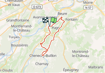
larnod- chenecey guillon- arguel

gerardmicheline
User

Length
20 km

Max alt
501 m

Uphill gradient
676 m
Km-Effort
29 km

Min alt
270 m

Downhill gradient
669 m
Boucle
Yes
Creation date :
2020-01-31 16:11:13.277
Updated on :
2020-01-31 16:46:21.065
6h11
Difficulty : Very difficult

FREE GPS app for hiking
 SityTrail
IGN / Geographical institutes
SityTrail Plus
The world is yours!
About
Trail Walking of 20 km to be discovered at Bourgogne-Franche-Comté, Doubs, Larnod. This trail is proposed by gerardmicheline.
Positioning
Country:
France
Region :
Bourgogne-Franche-Comté
Department/Province :
Doubs
Municipality :
Larnod
Location:
Unknown
Start:(Dec)
Start:(UTM)
725332 ; 5230150 (31T) N.
Comments