


Scaletta :

ARPF1
User
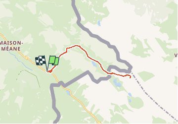

Length
13.7 km

Max alt
2738 m

Uphill gradient
906 m
Km-Effort
26 km

Min alt
1939 m

Downhill gradient
910 m
Boucle
Yes
Creation date :
2020-02-03 20:16:01.489
Updated on :
2020-02-03 20:17:10.939
5h30
Difficulty : Difficult

FREE GPS app for hiking
 SityTrail
IGN / Geographical institutes
SityTrail Plus
The world is yours!
About
Trail On foot of 13.7 km to be discovered at Provence-Alpes-Côte d'Azur, Alpes-de-Haute-Provence, Val-d'Oronaye. This trail is proposed by ARPF1.
Positioning
Country:
France
Region :
Provence-Alpes-Côte d'Azur
Department/Province :
Alpes-de-Haute-Provence
Municipality :
Val-d'Oronaye
Location:
Larche
Start:(Dec)
Start:(UTM)
332035 ; 4921559 (32T) N.
Comments