


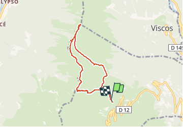
Grust Randonnée

philou6351
User

Length
8.8 km

Max alt
2081 m

Uphill gradient
465 m
Km-Effort
15 km

Min alt
1672 m

Downhill gradient
478 m
Boucle
Yes
Creation date :
2020-02-03 20:40:40.929
Updated on :
2020-02-03 20:42:13.338
3h02
Difficulty : Medium

FREE GPS app for hiking
 SityTrail
IGN / Geographical institutes
SityTrail Plus
The world is yours!
About
Trail Walking of 8.8 km to be discovered at Occitania, Hautespyrenees, Grust. This trail is proposed by philou6351.
Positioning
Country:
France
Region :
Occitania
Department/Province :
Hautespyrenees
Municipality :
Grust
Location:
Unknown
Start:(Dec)
Start:(UTM)
740046 ; 4753097 (30T) N.
Comments