


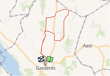
Garderes-M2-9km

mitch1952
User

Length
8.3 km

Max alt
407 m

Uphill gradient
65 m
Km-Effort
9.2 km

Min alt
371 m

Downhill gradient
64 m
Boucle
Yes
Creation date :
2020-02-05 23:23:52.728
Updated on :
2022-06-01 19:42:17.202
2h30
Difficulty : Very easy

FREE GPS app for hiking
 SityTrail
IGN / Geographical institutes
SityTrail Plus
The world is yours!
About
Trail On foot of 8.3 km to be discovered at Occitania, Hautespyrenees, Gardères. This trail is proposed by mitch1952.


Positioning
Country:
France
Region :
Occitania
Department/Province :
Hautespyrenees
Municipality :
Gardères
Location:
Unknown
Start:(Dec)
Start:(UTM)
734312 ; 4796009 (30T) N.
Comments