


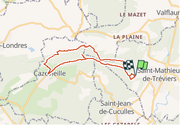
Tour du pic St loup

ARVIEU
User

Length
15.5 km

Max alt
645 m

Uphill gradient
820 m
Km-Effort
26 km

Min alt
151 m

Downhill gradient
819 m
Boucle
Yes
Creation date :
2020-02-10 12:22:34.093
Updated on :
2020-02-10 12:23:12.048
6h00
Difficulty : Difficult

FREE GPS app for hiking
 SityTrail
IGN / Geographical institutes
SityTrail Plus
The world is yours!
About
Trail On foot of 15.5 km to be discovered at Occitania, Hérault, Saint-Mathieu-de-Tréviers. This trail is proposed by ARVIEU.
Positioning
Country:
France
Region :
Occitania
Department/Province :
Hérault
Municipality :
Saint-Mathieu-de-Tréviers
Location:
Unknown
Start:(Dec)
Start:(UTM)
568245 ; 4846513 (31T) N.
Comments