


Boucle de la Roche Milliee

claude nier
User
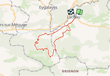

Length
14.2 km

Max alt
1238 m

Uphill gradient
547 m
Km-Effort
21 km

Min alt
718 m

Downhill gradient
547 m
Boucle
Yes
Creation date :
2020-02-13 13:00:18.068
Updated on :
2020-02-13 13:01:34.468
--
Difficulty : Medium

FREE GPS app for hiking
 SityTrail
IGN / Geographical institutes
SityTrail Plus
The world is yours!
About
Trail On foot of 14.2 km to be discovered at Auvergne-Rhône-Alpes, Drôme, Lachau. This trail is proposed by claude nier.
Description
a decouvrir
moyen car 14 kms mais 20 kms d 'effort
Positioning
Country:
France
Region :
Auvergne-Rhône-Alpes
Department/Province :
Drôme
Municipality :
Lachau
Location:
Unknown
Start:(Dec)
Start:(UTM)
710682 ; 4900797 (31T) N.
Comments