


Boucle de le Bruisse

claude nier
User
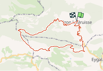

Length
11.8 km

Max alt
1248 m

Uphill gradient
539 m
Km-Effort
19 km

Min alt
836 m

Downhill gradient
545 m
Boucle
Yes
Creation date :
2020-02-13 13:14:29.199
Updated on :
2020-02-13 13:15:17.639
--
Difficulty : Medium

FREE GPS app for hiking
 SityTrail
IGN / Geographical institutes
SityTrail Plus
The world is yours!
About
Trail On foot of 11.8 km to be discovered at Auvergne-Rhône-Alpes, Drôme, Izon-la-Bruisse. This trail is proposed by claude nier.
Description
belle rando a decouvrir
Positioning
Country:
France
Region :
Auvergne-Rhône-Alpes
Department/Province :
Drôme
Municipality :
Izon-la-Bruisse
Location:
Unknown
Start:(Dec)
Start:(UTM)
706975 ; 4903559 (31T) N.
Comments