


11018269-Le Mage 17.50

togolo28
User
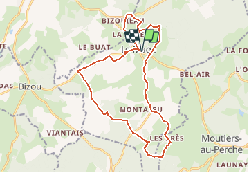

Length
17.5 km

Max alt
247 m

Uphill gradient
323 m
Km-Effort
22 km

Min alt
168 m

Downhill gradient
323 m
Boucle
Yes
Creation date :
2020-02-16 16:24:16.07
Updated on :
2020-02-16 16:25:13.081
--
Difficulty : Medium

FREE GPS app for hiking
 SityTrail
IGN / Geographical institutes
SityTrail Plus
The world is yours!
About
Trail Walking of 17.5 km to be discovered at Normandy, Orne, Le Mage. This trail is proposed by togolo28.
Positioning
Country:
France
Region :
Normandy
Department/Province :
Orne
Municipality :
Le Mage
Location:
Unknown
Start:(Dec)
Start:(UTM)
337944 ; 5374991 (31U) N.
Comments