


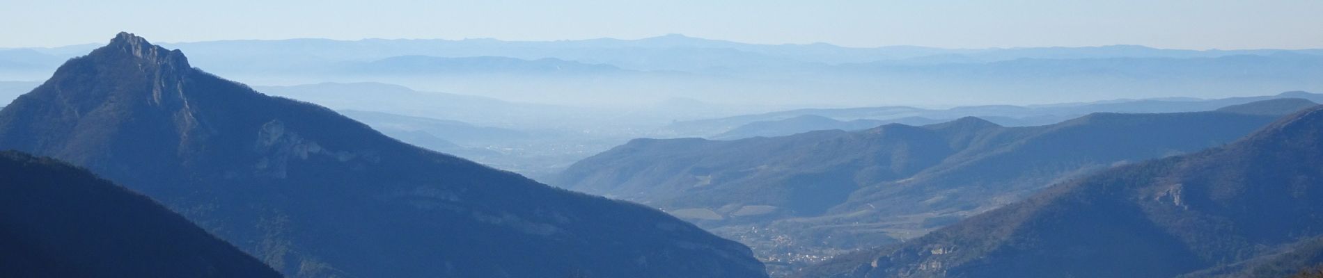
Les Balcons de la Roanne

bob2023
User
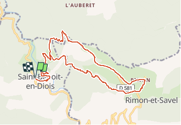

Length
13.3 km

Max alt
1000 m

Uphill gradient
711 m
Km-Effort
23 km

Min alt
348 m

Downhill gradient
710 m
Boucle
Yes
Creation date :
2020-02-16 18:50:58.17
Updated on :
2020-02-25 21:28:20.676
4h45
Difficulty : Difficult

FREE GPS app for hiking
 SityTrail
IGN / Geographical institutes
SityTrail Plus
The world is yours!
About
Trail Walking of 13.3 km to be discovered at Auvergne-Rhône-Alpes, Drôme, Saint-Benoit-en-Diois. This trail is proposed by bob2023.
Photos

Positioning
Country:
France
Region :
Auvergne-Rhône-Alpes
Department/Province :
Drôme
Municipality :
Saint-Benoit-en-Diois
Location:
Unknown
Start:(Dec)
Start:(UTM)
680097 ; 4948096 (31T) N.
Comments