


puydarrieux G4 reconnu

LouisROGER
User GUIDE
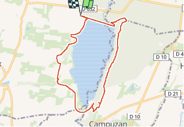

Length
9.5 km

Max alt
329 m

Uphill gradient
140 m
Km-Effort
11.3 km

Min alt
263 m

Downhill gradient
141 m
Boucle
Yes
Creation date :
2020-02-18 14:54:42.714
Updated on :
2022-07-09 08:41:11.845
2h25
Difficulty : Very easy

FREE GPS app for hiking
 SityTrail
IGN / Geographical institutes
SityTrail Plus
The world is yours!
About
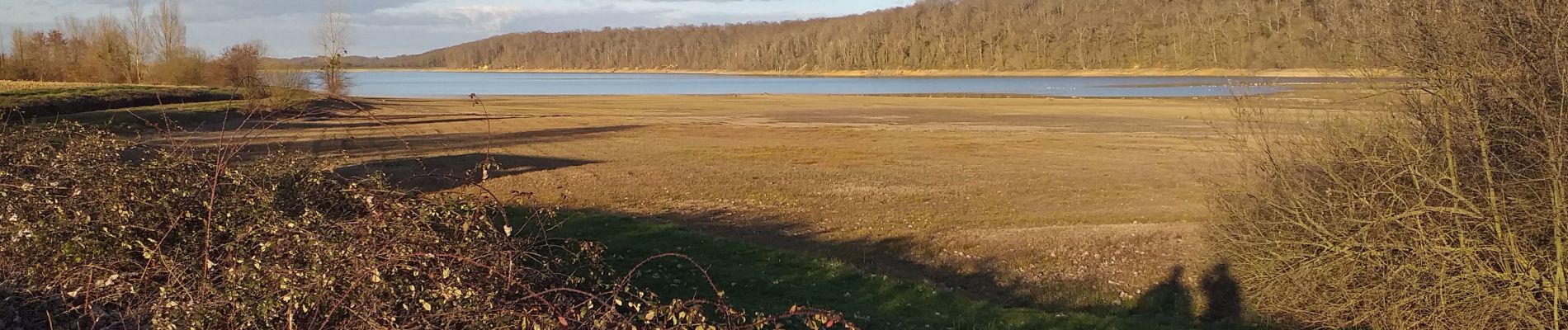
Trail Walking of 9.5 km to be discovered at Occitania, Hautespyrenees, Puydarrieux. This trail is proposed by LouisROGER.
Photos


Positioning
Country:
France
Region :
Occitania
Department/Province :
Hautespyrenees
Municipality :
Puydarrieux
Location:
Unknown
Start:(Dec)
Start:(UTM)
290676 ; 4797114 (31T) N.
Comments