


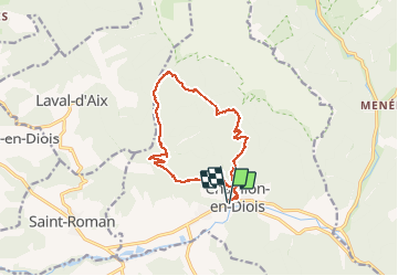
Combe de Baïn

ajd26
User

Length
14.8 km

Max alt
1178 m

Uphill gradient
878 m
Km-Effort
27 km

Min alt
578 m

Downhill gradient
875 m
Boucle
Yes
Creation date :
2020-02-20 08:19:12.0
Updated on :
2020-02-22 15:39:55.827
3h50
Difficulty : Easy

FREE GPS app for hiking
 SityTrail
IGN / Geographical institutes
SityTrail Plus
The world is yours!
About
Trail Walking of 14.8 km to be discovered at Auvergne-Rhône-Alpes, Drôme, Châtillon-en-Diois. This trail is proposed by ajd26.
Description
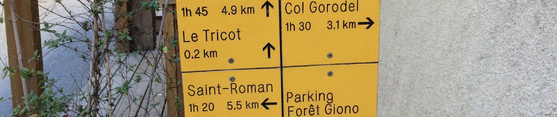
départ de Chatillon en Diois et direction col des Caux
on fait le tour du vallon, beaux panoramas
Photos


Positioning
Country:
France
Region :
Auvergne-Rhône-Alpes
Department/Province :
Drôme
Municipality :
Châtillon-en-Diois
Location:
Châtillon-en-Diois
Start:(Dec)
Start:(UTM)
696685 ; 4951940 (31T) N.
Comments