


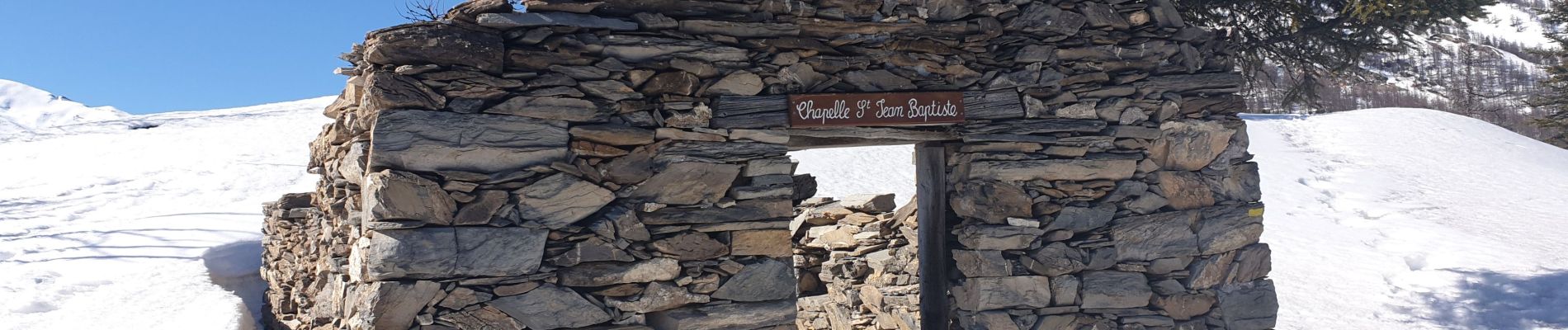
chapelle St Jean et les Forts de Tournoux

andre06130
User
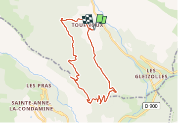

Length
9.3 km

Max alt
2000 m

Uphill gradient
536 m
Km-Effort
16.5 km

Min alt
1479 m

Downhill gradient
537 m
Boucle
Yes
Creation date :
2020-02-20 10:11:40.325
Updated on :
2022-02-10 16:07:48.364
3h40
Difficulty : Easy
--
Difficulty : Difficult

FREE GPS app for hiking
 SityTrail
IGN / Geographical institutes
SityTrail Plus
The world is yours!
About
Trail Walking of 9.3 km to be discovered at Provence-Alpes-Côte d'Azur, Alpes-de-Haute-Provence, Saint-Paul-sur-Ubaye. This trail is proposed by andre06130.
Description
superbes vues
un passage facile mais aérien
Photos


Positioning
Country:
France
Region :
Provence-Alpes-Côte d'Azur
Department/Province :
Alpes-de-Haute-Provence
Municipality :
Saint-Paul-sur-Ubaye
Location:
Unknown
Start:(Dec)
Start:(UTM)
320471 ; 4928413 (32T) N.
Comments