


Montigny l'Allier du 20/02/2020

VANDERPUTTENMi
User GUIDE
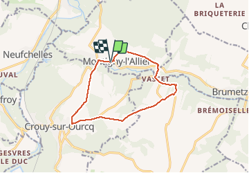

Length
11.3 km

Max alt
149 m

Uphill gradient
174 m
Km-Effort
13.6 km

Min alt
62 m

Downhill gradient
172 m
Boucle
Yes
Creation date :
2020-02-20 13:01:09.218
Updated on :
2020-02-26 10:36:04.507
2h58
Difficulty : Very easy

FREE GPS app for hiking
 SityTrail
IGN / Geographical institutes
SityTrail Plus
The world is yours!
About
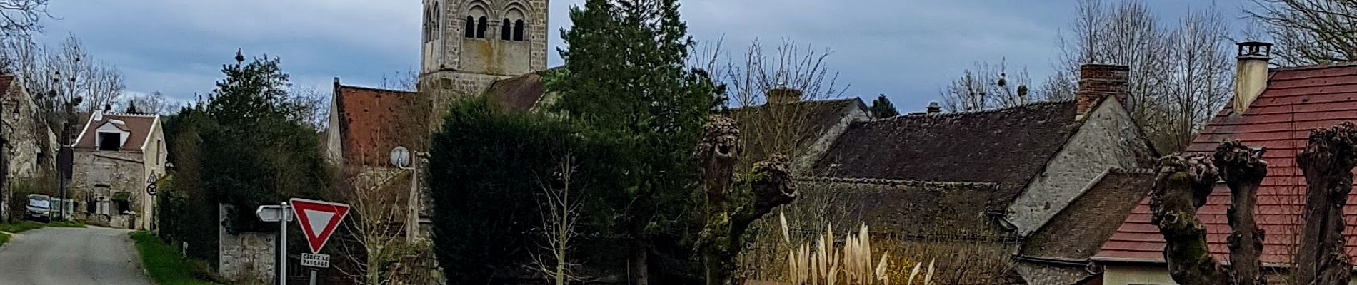
Trail Walking of 11.3 km to be discovered at Hauts-de-France, Aisne, Montigny-l'Allier. This trail is proposed by VANDERPUTTENMi.
Photos

Positioning
Country:
France
Region :
Hauts-de-France
Department/Province :
Aisne
Municipality :
Montigny-l'Allier
Location:
Unknown
Start:(Dec)
Start:(UTM)
507371 ; 5439852 (31U) N.
Comments