


Le Castellas Cuers

Christiancordin
User
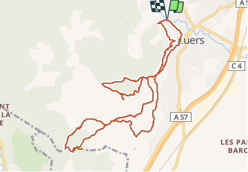

Length
13.8 km

Max alt
435 m

Uphill gradient
477 m
Km-Effort
20 km

Min alt
150 m

Downhill gradient
476 m
Boucle
Yes
Creation date :
2020-02-21 08:31:11.262
Updated on :
2020-02-21 14:25:44.102
3h49
Difficulty : Medium

FREE GPS app for hiking
 SityTrail
IGN / Geographical institutes
SityTrail Plus
The world is yours!
About
Trail Walking of 13.8 km to be discovered at Provence-Alpes-Côte d'Azur, Var, Cuers. This trail is proposed by Christiancordin.
Description
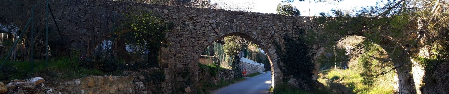
Cuers Aqueduc des 5 ponts Notre Dame de pitié le Castellas oppidum Chapelle Ste Christine.
Photos


21 photos in total. Please click on a photo to see them all in the gallery.
Positioning
Country:
France
Region :
Provence-Alpes-Côte d'Azur
Department/Province :
Var
Municipality :
Cuers
Location:
Unknown
Start:(Dec)
Start:(UTM)
261856 ; 4791713 (32T) N.
Comments