


batsere G3 fait

LouisROGER
User GUIDE
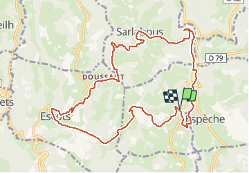

Length
13 km

Max alt
696 m

Uphill gradient
482 m
Km-Effort
19.4 km

Min alt
365 m

Downhill gradient
482 m
Boucle
Yes
Creation date :
2020-02-21 08:35:42.337
Updated on :
2020-02-21 14:37:11.052
4h57
Difficulty : Very easy

FREE GPS app for hiking
 SityTrail
IGN / Geographical institutes
SityTrail Plus
The world is yours!
About
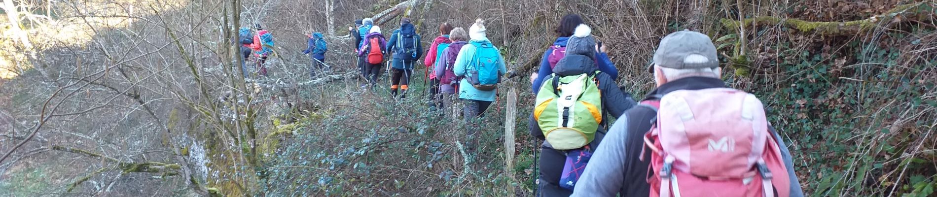
Trail Walking of 13 km to be discovered at Occitania, Hautespyrenees, Batsère. This trail is proposed by LouisROGER.
Photos


Positioning
Country:
France
Region :
Occitania
Department/Province :
Hautespyrenees
Municipality :
Batsère
Location:
Unknown
Start:(Dec)
Start:(UTM)
279236 ; 4771126 (31T) N.
Comments