


Douvres/salaport

gilbert57
User
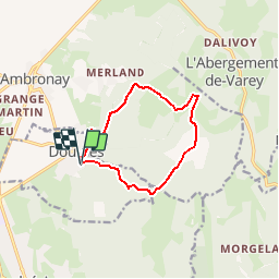

Length
10.2 km

Max alt
557 m

Uphill gradient
332 m
Km-Effort
14.7 km

Min alt
283 m

Downhill gradient
340 m
Boucle
Yes
Creation date :
2014-12-10 00:00:00.0
Updated on :
2014-12-10 00:00:00.0
3h04
Difficulty : Very easy

FREE GPS app for hiking
 SityTrail
IGN / Geographical institutes
SityTrail Plus
The world is yours!
About
Trail Walking of 10.2 km to be discovered at Auvergne-Rhône-Alpes, Ain, Douvres. This trail is proposed by gilbert57.
Positioning
Country:
France
Region :
Auvergne-Rhône-Alpes
Department/Province :
Ain
Municipality :
Douvres
Location:
Unknown
Start:(Dec)
Start:(UTM)
683948 ; 5095289 (31T) N.
Comments