


Srre / Pulchère

MacGil
User

Length
11.3 km

Max alt
555 m

Uphill gradient
391 m
Km-Effort
16.5 km

Min alt
409 m

Downhill gradient
393 m
Boucle
Yes
Creation date :
2020-02-22 10:31:08.919
Updated on :
2020-02-23 08:21:04.813
1h14
Difficulty : Very easy

FREE GPS app for hiking
 SityTrail
IGN / Geographical institutes
SityTrail Plus
The world is yours!
About
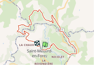
Trail Running of 11.3 km to be discovered at Auvergne-Rhône-Alpes, Loire, Saint-Médard-en-Forez. This trail is proposed by MacGil.
Positioning
Country:
France
Region :
Auvergne-Rhône-Alpes
Department/Province :
Loire
Municipality :
Saint-Médard-en-Forez
Location:
Unknown
Start:(Dec)
Start:(UTM)
606328 ; 5050368 (31T) N.
Comments