


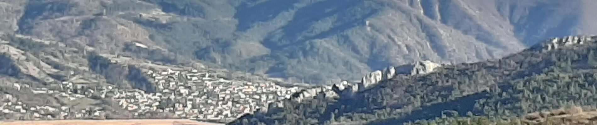
CHATEAU ARNOUX Le sentier des bruyeres o

RobinMicheline
User GUIDE
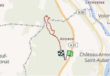

Length
6.8 km

Max alt
668 m

Uphill gradient
226 m
Km-Effort
9.8 km

Min alt
535 m

Downhill gradient
223 m
Boucle
Yes
Creation date :
2020-02-23 14:03:38.601
Updated on :
2020-02-23 16:23:08.744
2h17
Difficulty : Easy

FREE GPS app for hiking
 SityTrail
IGN / Geographical institutes
SityTrail Plus
The world is yours!
About
Trail Walking of 6.8 km to be discovered at Provence-Alpes-Côte d'Azur, Alpes-de-Haute-Provence, Château-Arnoux-Saint-Auban. This trail is proposed by RobinMicheline.
Description
sympa
Photos


Positioning
Country:
France
Region :
Provence-Alpes-Côte d'Azur
Department/Province :
Alpes-de-Haute-Provence
Municipality :
Château-Arnoux-Saint-Auban
Location:
Unknown
Start:(Dec)
Start:(UTM)
739356 ; 4886504 (31T) N.
Comments