


La Chartreuse de Valbonne Sud

Nathy8913
User
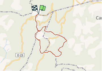

Length
7.4 km

Max alt
348 m

Uphill gradient
308 m
Km-Effort
11.6 km

Min alt
201 m

Downhill gradient
308 m
Boucle
Yes
Creation date :
2020-02-24 12:43:20.136
Updated on :
2020-02-24 12:43:30.275

FREE GPS app for hiking
 SityTrail
IGN / Geographical institutes
SityTrail Plus
The world is yours!
About
Trail of 7.4 km to be discovered at Occitania, Gard, Saint-Paulet-de-Caisson. This trail is proposed by Nathy8913.


Positioning
Country:
France
Region :
Occitania
Department/Province :
Gard
Municipality :
Saint-Paulet-de-Caisson
Location:
Unknown
Start:(Dec)
Start:(UTM)
624138 ; 4899644 (31T) N.
Comments