


La Dent du Serret

Nathy8913
User
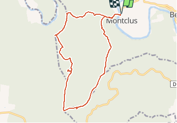

Length
9.5 km

Max alt
313 m

Uphill gradient
288 m
Km-Effort
13.4 km

Min alt
85 m

Downhill gradient
289 m
Boucle
Yes
Creation date :
2020-02-24 12:47:05.121
Updated on :
2020-02-24 12:47:05.121

FREE GPS app for hiking
 SityTrail
IGN / Geographical institutes
SityTrail Plus
The world is yours!
About
Trail of 9.5 km to be discovered at Occitania, Gard, Montclus. This trail is proposed by Nathy8913.
Points of interest


Positioning
Country:
France
Region :
Occitania
Department/Province :
Gard
Municipality :
Montclus
Location:
Unknown
Start:(Dec)
Start:(UTM)
613382 ; 4902035 (31T) N.
Comments